Cities in Text Project
The purpose of this project is to provide access to historic travel literature and the buildings and monuments they describe virtually. Travel literature and guidebooks offer unique insights into how urban environments were traversed and viewed. Written and illustrated during a time when travel was considered an activity that enhanced an individual’s education, these books provide critical insights to the ancient and modern wonders of Rome. Few cities are as well documented as Rome. Hundreds of travel guides were produced from the sixteenth to the nineteenth century, encouraging informative tourism. These historical guides are underutilized today, primarily due to lack of access, as most are housed in rare book collections at academic institutions. By physically removing barriers to their access the modern scholar and interested traveler can experience the development of the city of Rome chronologically through the distinct periods of the city’s history.
This project allows one to view the city of Rome dynamically, peeling back its layers and experiencing its urban and architectural transformation through three hundred years of its history. This website and the accompanying mobile application combine historic texts, digital images, translations, and mapped itineraries to study the evolution of Rome. It allows the user to develop their understanding of how historic cities are viewed by physically taking the documentation on site and recording personal interpretations using features found in the mobile application.
Cities in Text: Rome is a work in progress. At present the site contains three selected travel guides as well as accompanying images and translations that are as literal and simple as possible. Additional images and building descriptions are added daily. The hope is that this project will grow to include other historical travel guides on Rome and additional library partnerships. The Resources tab will expand to include additional bibliographies, library catalogs, project findings, and related research.
This website works in conjunction with the mobile application (available in the App Store for iPad) that will allow one to walk the daily tours of Rome as described in the text. Features of the application include geolocation, building and monument descriptions, brief excerpts from the selected texts in English and Italian, and the ability to take notes and email them to yourself.
Chosen Books in Context
The publications selected for this project were chosen to build the website and mobile application, not to provide an exhaustive catalog of travel literature. In order to construct a robust resource capable of displaying content from various points in time, the team partnered with the Library of the American Academy in Rome. The collection housed in the Barbara Goldsmith Rare Book Room contain more than seventy historical guides to Italian art and architecture. The team chose to focus strictly on those dedicated solely to Rome leaving forty-three publications. Of the remaining texts the team was particularly interested in books that described the entire city, included an extensive series of illustrations, focused on the historic urban environment, dedicated more time to buildings and monuments than works of art, and, if possible, contained daily itineraries.
After consultation between the Notre Dame and American Academy in Rome librarians, faculty, and the architecture students, three important texts from three different centuries were chosen to begin the project. Each of the three presented compelling snapshots of Rome during the time they were published. The first text selected was the second edition of Bernardo Gamucci’s Le Antichitá della cittá di Roma published in 1569. Gamucci’s beautifully illustrated woodblock prints focused primarily on ancient monuments. More than four hundred travel guides were published in the sixteenth century but this particular publication was very well received during the Renaissance and found a home in many important libraries worldwide.
To represent the seventeenth century the team selected Descrittione di Roma Antica e Moderna… published in 1643 by Federico Franzini. According to Sergio Rossetti’s impressive Rome: A Bibliography from the Invention of Printing Through 1899, I, The Guide Books (2000), this text is the 191st of 469 guidebooks on Rome published in the seventeenth century. This particular book was selected because of the extensive illustrations it provided coupled with a three-day itinerary that presents Rome holistically paying as much attention to the ancient as well as the modern sites.
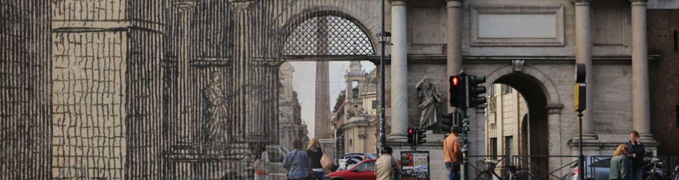
Giuseppe Vasi’s Itinerario Istruttivo Diviso in Otto Giornate… was an obvious selection to represent the eighteenth century. The extensive, eight-day, itinerary covers more than 100 miles as it traverses the city stopping at more than 400 buildings and monuments. Day one alone, beginning at the Ponte Milvio and ending in front of the church of Santa Croce in Gerusalemme, covers 85 sites and expands over 23 walked miles. Vasi has a lot to say about Rome and provided his readers with incredibly detailed views of the city along with extensive illustrations - many of which were linked to his outstanding vedute (views) of Rome. This text presented the team with the most complex dataset to work with and became the foundation of the project.
Translations
Translations of the three books are currently a work in progress. Transcriptions from the original Italian text have been made, followed by literal English transcriptions.
The names of streets, piazzas, gates, churches, and chapels are given in modern Italian, with few exceptions such as St. Peter’s, the Sistine Chapel, Lateran Basilica, and the Apostolic Palace of the Lateran which are given in English. The names of popes and saints have been translated in cases where they are in current English usage, in all other cases, they are given in modern Italian. The names of famous historical figures of antiquity are given in their original Latin rather than in Italian. We have retained Gamucci, Franzini, and Vasi’s inconsistent style in the citations of numbers, and followed as closely as possible their use of capital letters.
For the names of monuments and artists, sculptors, and architects, we have retained the three authors Italian in the text except for Nicolas Poussin and Giacomo Barozzi da Vignola for greater clarity. Note that there is an inconsistency of artists names in Vasi’s text where he often uses different spellings to describe the same artists. Where monuments in question have a standard equivalent in English, that version can also be found in the monument descriptions. We have aimed to provide a consistent translation that conveys the three authors meaning as literally and simply as possible. We did not attempt to give a contemporary interpretation of the text since these authors were not writers of our time. Names, phrases, and descriptions in Latin have been retained and italicized within the body of the translation for consistency in conveying the differentiation from Italian in the original texts.
Additional Publications and Images
Much of Vasi's tour of Rome is not illustrated, however it contains references to illustrations in his massive 10 volume Delle Magnificenze di Roma published between 1747 and 1761. Whenever possible we have included the plates from Delle Magnificenze digitized by the American Academy in Rome. Many building from his daily itineraries have been demolished, destroyed, or altered beyond recognition. In order to provide a comprehensive view of Roman architecture, we have included digitized content from the rare book collection housed in the Hesburgh Libraries of Notre Dame's Architecture Library. A full bibliography of the publications included can be found in the Resources section of this site under 'Bibliographies.'
Sequencing Vasi - Challenges and solutions to mapping an 18th century text onto 21st century Rome.
Several challenges have arisen while attempting to map Giuseppe Vasi’s 18th century itineraries of Rome using 21st century resources. The team has been as faithful to the itineraries and text as possible. The challenges faced, and solutions created, are documented here.
One of these challenges was how to record structures that Vasi mentions but doesn’t number as a stop on the walk. Initially, our solution was to include them as additional views but not to trace a walk directly to them, identifying them with a dot and as a sub-category on the itinerary, labeling them as ‘a,’ ‘b,’ ‘c,’ etc. after the number on the stop they represent. However, this approach to labeling proved problematic in the programming and sequencing and had to be abandoned at this stage. The team hopes to add this in a later update.
Another challenge was how to represent lost or destroyed stops along his itineraries. For the this project we have chosen to include monuments or structures that are no longer standing. Those structures are represented by the additional digitized publications found in the Resources section. In the case of missing numbers along the itinerary, those either skipped or left out by Vasi, we have followed his system and not included them.
Benefits of this Project
The platforms created for this project, the website and mobile application, serve as tools for creating and presenting digital scholarship. This project provides a methodological approach to the multimedia representation of architectural and urban heritage, through the development of a research tool that extends the capabilities of traditional forms of primary and secondary source material. By combining traditional library resources, such as historical publications and archival documentation, with geolocation and mobile technologies users are able to break the physical constraints of the library and take historical resources on site as they physically examine a geographic location.
Using Historic Documentation
The static nature of traditional methods of visual representation has limited the ways scholars are able to communicate large bodies of visual data related to the built environment. The recent development of digital visualization and representational tools has opened up new veins of research and possibilities for both professionals and scholars studying the built environment, allowing for greater synergy between traditional and digital means of analyzing architecture and urban form. Advancements in integrative and digital approaches to the study of the historic urban environment is a necessity for urban scholars, educators, and students.
Cities in Text: Rome is an exercise in the digital deployment of traditional scholarship focused on architecture and the built environment. Few tools exist that allow one to understand the complex layers of a city’s urban development. This project was conceived to provide multimedia representations of architectural and urban heritage, to offer scholars, students, and the general public research tools that extend the capabilities of traditional forms of primary and secondary source material.